
Ontario (ON)
Type of resources
Topics
Keywords
Contact for the resource
Provided by
Years
Formats
Representation types
Update frequencies
status
-
Environmental pollutants can cause genetic damage to wildlife, which can have impacts at the population level. Thus, identifying chemicals and complex mixtures that can cause genetic damage and monitoring their effects in exposed wildlife populations is an important component of chemical and ecological risk assessment and management. This project will apply modern methods in molecular biology to develop tools for measuring genetic damage in cultured cells, laboratory animals, and wild species. These tools will be used to screen large numbers of chemicals for potential genotoxicity in the laboratory, and to monitor the genetic health of wildlife species in polluted areas.
-
This project sheet is for the last year of an OMOECC and ECCC agreement, on the toxicity of neonicotinoids. Half of the money was split with Stacey Robinson (20K). This portion of the work for this project was to assess the hazard of these pesticides to mussels and benthic invertebrates, along with scientists from ACRD, at CCIW.
-
Snapping turtles have been used by the EC since the early 1980s to determine spatial and temporal trends in PCB (and other organochlorine) concentrations, and have furthermore been used extensively for assessing AOCs. There is some concern, however, that their longevity may pose problems in interpreting body burdens. Given that Chelydra can live for over 50 years, individuals would be exposed to temporally varying levels of PCBs over their lifetime. Assessment of their body burdens, either through eggs, plasma, or other tissues, will indicate the temporal integration of PCBs over their lifetime, with the caveat that the proportion of PCBs from any given time period to the current burden will decline over time. The objective is to estimate depuration rates of PCBs in turtles to determine how much contribution past exposures have on the current tissue burden. In addition, there is very little information on the toxicity of PCBs to turtles. This project will assess toxicity, using genetic biomarkers (e.g. P450, oxidative stress, heat shock proteins, thyroid, and others), of PCB exposure to snapping turtles exposed through diet.
-
The tumor suppressor gene (TP53) is a biomarker of exposure and toxicity of PAHs, or other mutagens and genotoxins. The TP53 pathway regulates gene repair, cellular growth, and apoptosis, following induced genetic damage. We will be using avian (double crested cormorant) models from laboratory egg injection studies to develop these assays. Our goal is to assess the effects of PAH containing mixtures to cormorants in ovo (egg injections), by examining transcriptomics of the TP53 pathway in the embryo. Cormorant eggs will be injected with the PAH mixture, and at pipping. embryos will be sacrificed, genomic DNA extracted from tissues, and sequenced for mRNA to evaluate the TP53 signalling pathway, and the up- or down-regulation of key promoter and regulator genes such as P21, BAX, GADD45, P53R2, and MDM2.
-
Mining of chromium and its use in industrial activities can impact the environment as may happen in Northern Ontario were large chromium deposits were discovered. This project aimed at determining impacts of chromium exposure on native plants, including species from the Nibinamik Indigenous Peoples region in the Ring of Fire. Seed germination assays and a germinable seed study from soil seedbanks (using soil samples collected from the Ring of Fire) were conducted. Mutants of the model species Arabidopsis thaliana with known seed coat components (different levels of suberin, lignine and mucilage) are being tested to determine the mechanism of chromium toxicity.
-
The main radar covering the Toronto Area is the King City Doppler Dual-Polarization C-Band radar (43.96388, -79.57416). Other nearby radars include the Exeter Doppler C-Band radar (43.37027,-81.38416) and the Buffalo Doppler Dual-Polarization S-Band radar (42.94889,-78.73667) from the United States. Though the primary radar for the project is the King City radar, the raw data from all three radars are included in their native format (IRIS or Nexrad Level 2) and are intended for radar specialists. The data is available from May 1 2015 to Sept 30 2015. The scan strategy for each radar is different, with at least 10 minute scan cycles or better. The user should consult with a radar specialist for more details. Reflectivity and radial velocity images (presented as a pair) for the lowest elevation angle (0.5o) centred on a 128 km x 128 km box around from the King City radar are provided for general use. Besides their normal use as precipitation observations, they are particularly useful to identify Lake Breezes as weak linear reflectivity and as radial velocity discontinuity features for the entire period. The target providing the radar returns are insects. Analysis indicates the presence of Lake Breezes on 118 days, only 35 days did not have any kind of lake breeze-like features. Daily movies have been created. The format of the single images is PNG and the movies is an animated GIF. The data is organized by radar and by day in the following structure. The raw data is organized in the following directory structure: RADAR - greater than lesser than WKR|WSO|BUF greater than - greater than YYYY - greater than YYYYMM - greater than YYYYMMDD; where YYYY is the appropriate year (always 2015), MM is the month, DD is the day. The images are organized as: RADAR - greater than QUICKLOOK - greater than YYYY - greater than YYYYMM - greater than YYYYMMDD; where YYYY is the year, MM is the month, DD is the day. The movies are located in the YYYYMMDD folders and are named as YYYYMMDD_movie.gif
-
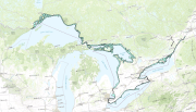
The coast of South-Eastern Georgian Bay has numerous bays and inlets. This area is an important resource for drinking water, recreation and fish habitat. While offshore water quality of Georgian Bay is not impaired, nearshore embayments and inlets, in some instances, have been reported to experience water quality degradation. Concerns include excess nutrients, increased frequency of cyanobacteria blooms and hypoxia. The Lake Simcoe Clean-up Fund was expanded in 2012 to include the South East shore of Georgian Bay. This mandate allowed for researchers to assess water quality and nuisance and toxic algal blooms within a geographical scope from the Nottawassaga Valley Watershed to the coast of Georgian Bay between Port Severn and the French River. The program was completed in 2017. Lake Simcoe is the fourth largest lake entirely in Ontario. It is part of the Trent Severn Waterway connecting Georgian Bay to Lake Ontario where tourism generates more than $200 million per year. In 2007-2012 the Lake Simcoe Cleanup Fund was created to address the increased phosphorus loading from point and non-point sources, research and monitoring to improve environmental information for decision making and conservation of fish and aquatic wildlife habitat. Collaborative research between a number of government and non-government stakeholders have contributed to monitoring, research and management of Lake Simcoe to ensure long term ecosystem health of this valuable resource.
-
Azo dyes are synthetic compounds used as industrial colorants, and some are predicted to be inherently toxic, bioaccumulative, and/or persistent based upon their chemical composition. This study addressed data gaps in current research which included the need to evaluate the toxicity of hydrophobic azo dyes to benthic invertebrates. The toxicity of a solvent dye, Sudan Red G (SRG), and two disperse dyes, Disperse Yellow 7 (DY7) and Disperse Orange 13 (DO13), to Hexagenia spp. and Tubifex tubifex was assessed in spiked-sediment exposures. The dye compounds appeared to degrade readily in the equilibrium and exposure periods, suggesting a limited persistence of the parent compounds in the environment under test conditions.Although azo dye degradation products could not be reliably quantified, one was detected in DY7 sediment samples that elicited toxic effects to Hexagenia and Tubifex, providing evidence that DY7 degrades. Hexagenia survival and growth endpoints responded with similar sensitivity to the dyes, but DY7 was the most toxic, with a 21-day IC25 (concentration associated with 25% inhibition) for growth of 9.6 μg/g. Comparatively, Tubifex reproduction was the most sensitive endpoint for all dyes with 28-day IC25s for young production ranging from 1.3 to 11.8 μg/g. At sublethal concentrations, toxic effects to Tubifex differed between dyes: the solvent dye exerted an effect primarily on gametogenesis (cocoon production), while disperse dyes, most notably DY7, caused effects on embryogenesis(development of worm inside the cocoon). This study indicated that there could be potential hazard to oligochaetes based on the observed effect concentrations, but given the lack of environmental measurements, the risk of these compounds is unknown. Further research is required to determine if degradation products were formed in all dye samples and whether toxicity was caused by the parent molecules, which have limited persistence under test conditions, or by their degradation products. To avoid underestimating toxicity, this study stresses the need to use an infaunal deposit feeder such as the oligochaete Tubifex in sediment toxicity assessments where highly hydrophobic compounds are present.
-
Mesoscale boundaries have an important influence on mesoscale weather. They can trigger, enhance or inhibit convections and severe weather. They are also indicators of shifts in wind speed and direction, temperature and relative humidity, and can affect air quality and heat indices. Around the Great Lakes, it has been observed that mesoscale boundaries are prevalent and can have complex interactions between each other. A mesoscale boundary is the interface between two air masses for weather phenomenon on a scale of 5km to 100km. Mesoscale boundaries are generally associated with wind and differences in temperature, pressure and relative humidity. During the 2015 Pan Am and Parapan Am Games periods, boundary information were collected from July 10 to August 15, 2015. These included lake and land breeze fronts, outflow boundaries, as well as merged and other boundaries. Each mesoscale boundary is represented as a curve on the surface of the Earth with a list of coordinates. The data are stored in GeoJSON format and Shapefiles. A CSV file summarizes all the properties of the boundaries, but does not include any geometric information.
-
The Great Lakes Migrant Waterfowl Surveys provide periodic data on waterfowl abundance, spatial and temporal distributions, and use along the shorelines of major water bodies and river systems in Ontario during mostly during spring and fall, and to a lesser extent during summer and winter, seasons. The primary survey area covers the shoreline and nearshore (~1km) waters of the Lower Great Lakes region of Ontario, specifically including the St. Lawrence River, Lake Ontario, Niagara River, Lake Erie, Detroit River and Lake St. Clair and associated major marshes and embayments. Aerial surveys, typically flown several times within spring (March –May: 1969, 1971, 1972, 1975 –1979, 1981, 1982, 1984 –1988, 1991 –1996, 1998 –2003 & 2009 –2011) and fall (September –December: 1968, 1970, 1971, 1974 –2003 & 2009 –2011) survey periods, have been conducted periodically on a relatively regular basis (approx. 5-10 years) along the Lower Great Lakes shorelines between 1968 and 2011. Smaller-scale surveys also have been conducted periodically during summer (June –August: 1968 –1970, 1972, 1974, 1975, 1977, 1982, 1984, 1986, 1989, 1999 & 2002) in this region. This survey often has been conducted in conjunction with the Midwinter Survey, so its data (up to 2004) also are included in the CWS Migrant Waterfowl Surveys database (Year ≥2004 & Month = January & February).Data from several aerial surveys conducted periodically during the non-breeding period outside the Lower Great Lakes region also are included in this database. Spring and fall surveys have been conducted along the shorelines and nearshore waters of the Upper Great Lakes region of Ontario, specifically at St. Clair River (Fall 2012 & 2013), Lake Huron (Fall 1973, 1996; Spring 1974) / Georgian Bay (Fall 1973, 1996, 2012 & 2013) & Lake Superior (Fall 2000). Aerial surveys also have been conducted inland in southeastern Ontario along the Rideau River (Fall 1998 & Spring 1999).